Case Study
Sinkhole Detection & Monitoring

01.
Overview.
Sinkholes had become a growing problem for administrators. The need arose to identify individual sinkhole locations, their proximity to areas with high water run-off, and if possible, their depth. The goal was to effectively address the safety concerns brought on by the sinkholes' close proximity to public trails and walking paths.
02.
Challenges and Solutions.
The sinkholes in the park were expanding due to heavy rains and were becoming an increasing concern. These sinkholes can be 70 to 80 feet deep in some spots and represent a danger to structures, roads, vehicles, walking trails, people and wildlife. While many of the sinkhole areas were known and documented, the dense vegetation covered several acres of potentially sinkhole ridden land where no data exists. Drone based LiDAR offers an invaluable advantage due to the laser's ability to collect data through small openings in tree canopies. Establishing a strong network of on-site control points prior to flying was vital in ensuring the accuracy and validity of our data. .
03.
Results.
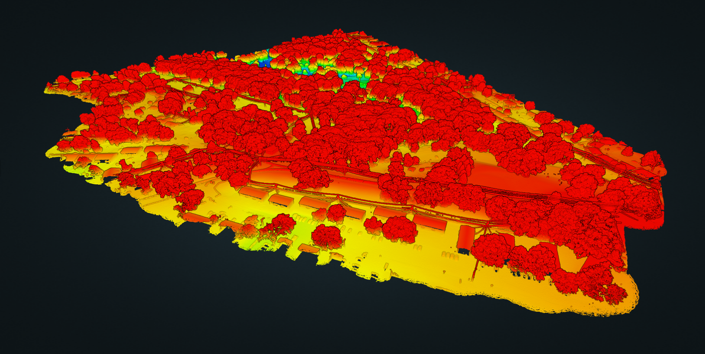
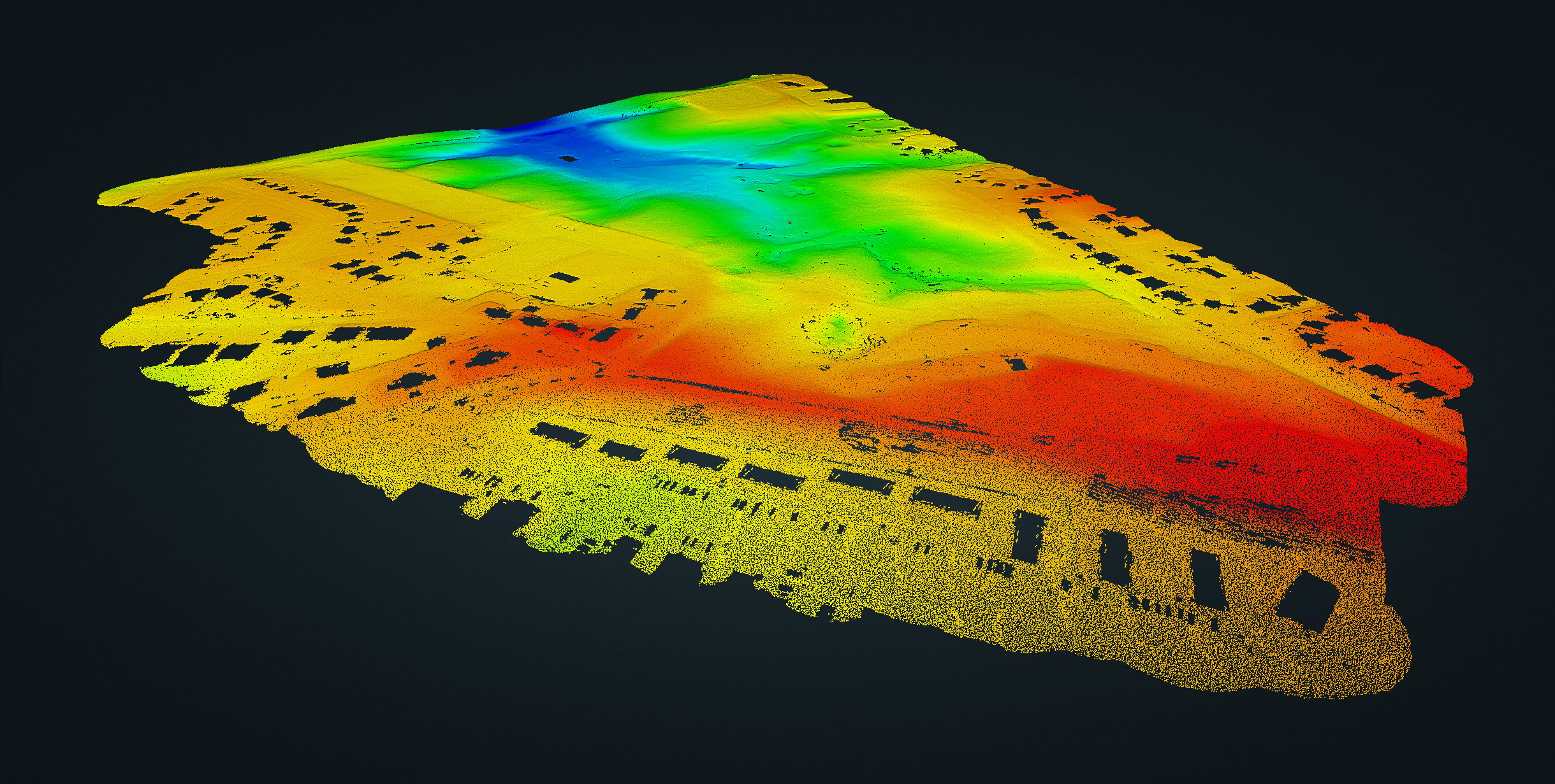
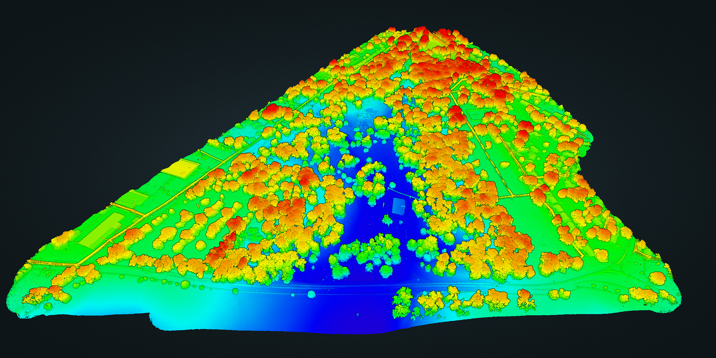
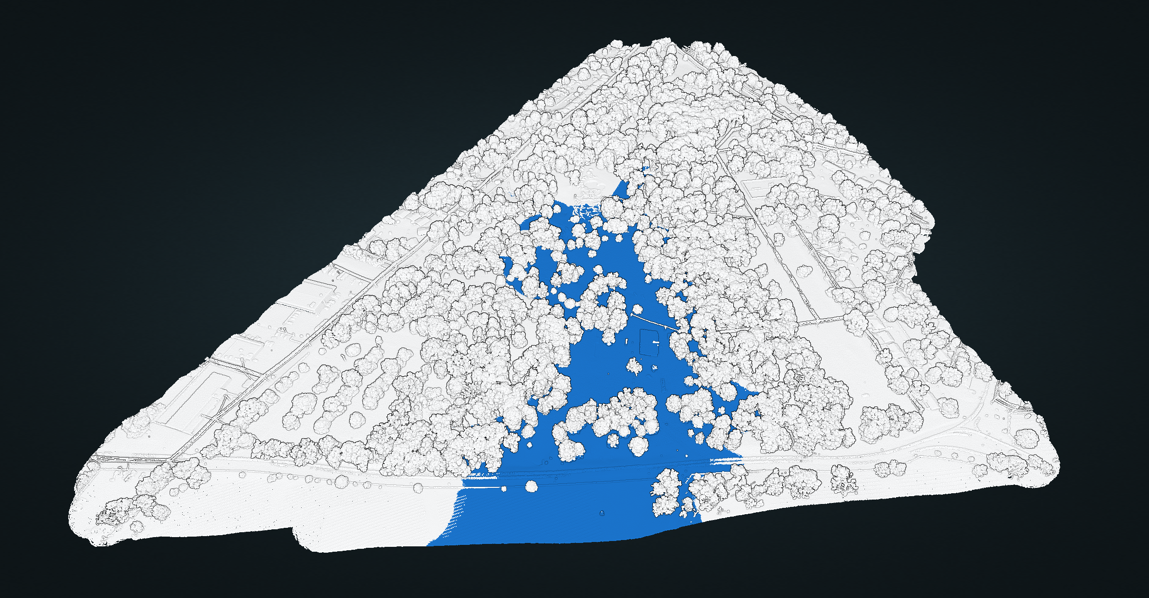
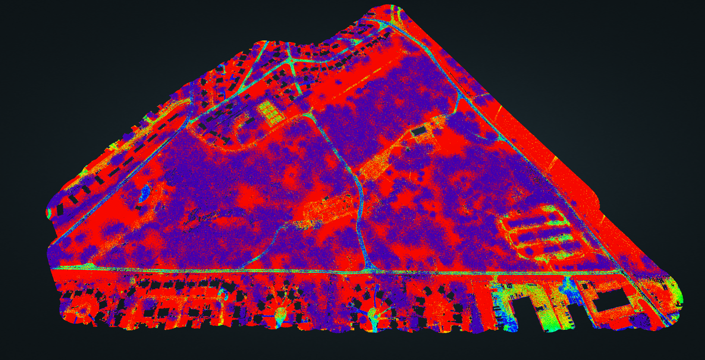
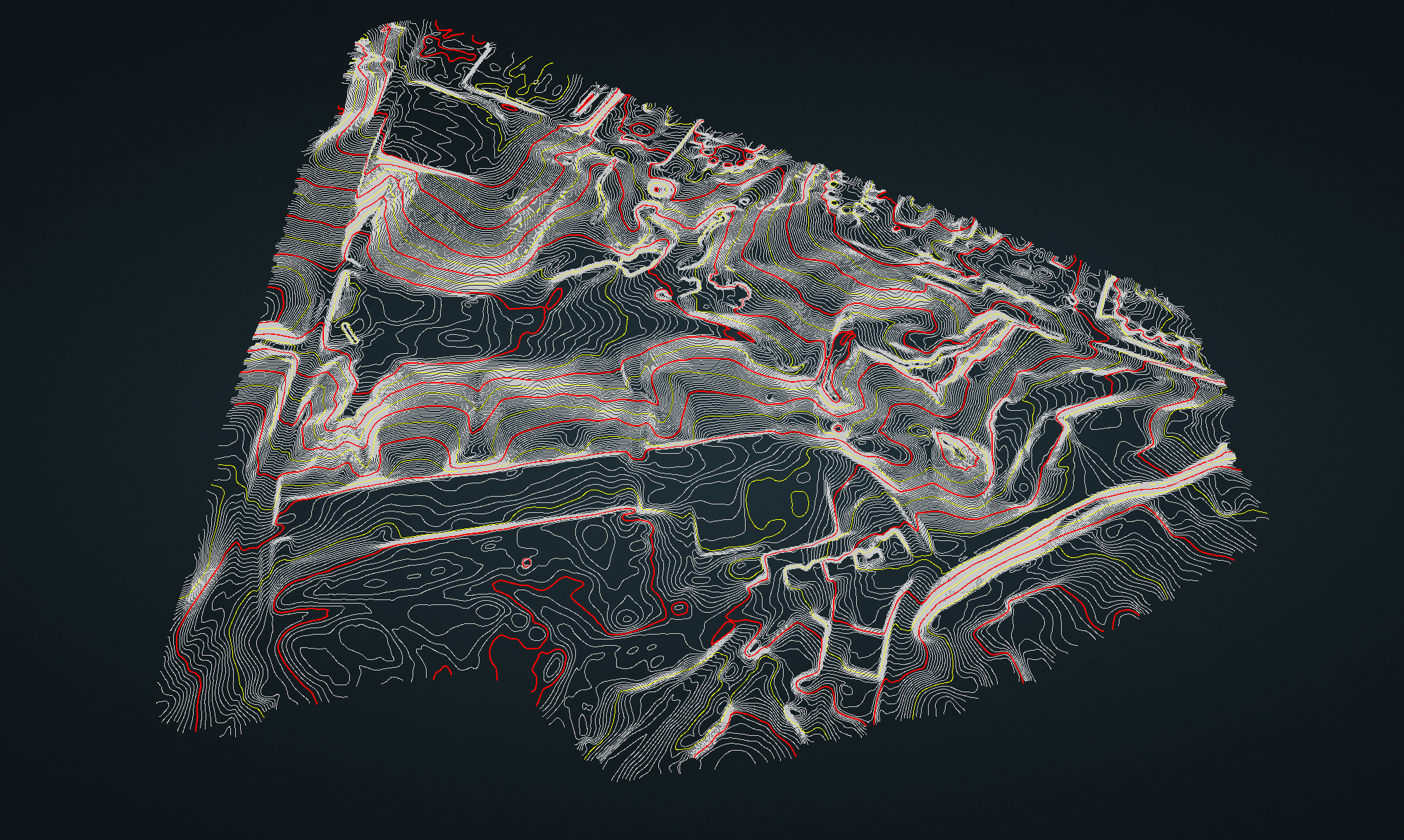
By cross referencing the runoff data against the most concerning sinkholes, the end user has the critical information needed to help make decisions on sinkhole remediation and how to slow the pace of erosion in those areas. Additionally, the LiDAR data was used to perform slope and flood analysis. Furthermore, the data clearly showed where the water flows from and pools the most. Using that data, decisions can be made on where to make earthwork changes like redirecting water, implementing new drainage systems, and adding or removing dirt to reduce erosion.


